When you click on links to various merchants on this site and make a purchase, this can result in this site earning a commission. Affiliate programs and affiliations include, but are not limited to, the eBay Partner Network.
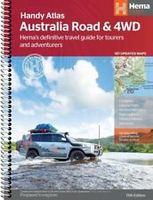
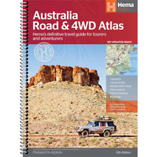
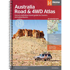
Hema Australia Road and 4WD Easy Read Atlas 187 Updated Maps (Spiral Bound)Featuring trusted Hema mapping for all of Australia, the Hema Road & 4WD Easy Read Atlas is the definitive travel guide for tourers and adventurers. Hema atlases feature more information useful to travellers, including 4WD tracks, campsites, caravan parks, rest areas, 24-hour fuel and points of interest. This edition contains more mapping than ever before, which is enhanced by a striking new cartographic style that\'s incredibly easy to read. Included in this is up-to-date mapping for Australia\'s biggest 4WD destinations: Cape York, Fraser Island, the Top End, the Kimberley, the Pilbara, Central Australia, High Country Victoria and the Flinders Ranges. A handy distance grid, national park guide, list of accredited information centres and a complete index are also included to assist with trip planning and navigation, making it the perfect tool for guiding tourers, campers, road trippers and off-roaders throughout Australia. Edition: 13th Publication Date: 31/01/22 Number of Pages: 224 Australian owned & operated with local customer supportAbout Us Delivery & Returns Payment FAQ Add to Favourites
- Gadgets & Gizmos
- Outdoors & Camping
- Home & Living
- Fashion & Beauty
- Toys & Games
- Office & Tech
- Entertainment
- Kids & Baby
Hema Australia Road and 4WD Easy Read Atlas 187 Updated Maps (Spiral Bound) SKU: 192396
×
Buy now and save!
Featuring trusted Hema mapping for all of Australia, the Hema Road & 4WD Easy Read Atlas is the definitive travel guide for tourers and adventurers.
Hema atlases feature more information useful to travellers, including 4WD tracks, campsites, caravan parks, rest areas, 24-hour fuel and points of interest.
This edition contains more mapping than ever before, which is enhanced by a striking new cartographic style that\'s incredibly easy to read.
Included in this is up-to-date mapping for Australia\'s biggest 4WD destinations: Cape York, Fraser Island, the Top End, the Kimberley, the Pilbara, Central Australia, High Country Victoria and the Flinders Ranges.
A handy distance grid, national park guide, list of accredited information centres and a complete index are also included to assist with trip planning and navigation, making it the perfect tool for guiding tourers, campers, road trippers and off-roaders throughout 13th
Publication Date: 31/01/22Number of Pages: 224 You might also like CollectA Realistic Animal Replica Scimitar Horned Oryx Figure Large Ages 3+ CollectA Realistic Animal Replica Sciurumimus Dinosaur Figure Medium Ages 3+ CollectA Realistic Animal Replica Sea Lion Figure Large Ages 3 Years and Up CollectA Realistic Animal Replica Shetland Silver Dapple Pony Figure Medium
Shopping With Us
- Why Shop at LatestBuy?
- Delivery
- FAQ\'s
Help Topics
- Returns
- Payment
- Terms & Conditions
Gift Ideas
- Gadgets & Gizmos
- Outdoors & Camping
- Home & Living
- Fashion & Beauty
- Toys & Games
- Office & Tech
- Entertainment
- Kids & Baby
Safe & Easy PaymentSubscribe To Our NewsletterSign Me UpCopyright 2023 © LatestBuy


")