
When you click on links to various merchants on this site and make a purchase, this can result in this site earning a commission. Affiliate programs and affiliations include, but are not limited to, the eBay Partner Network.

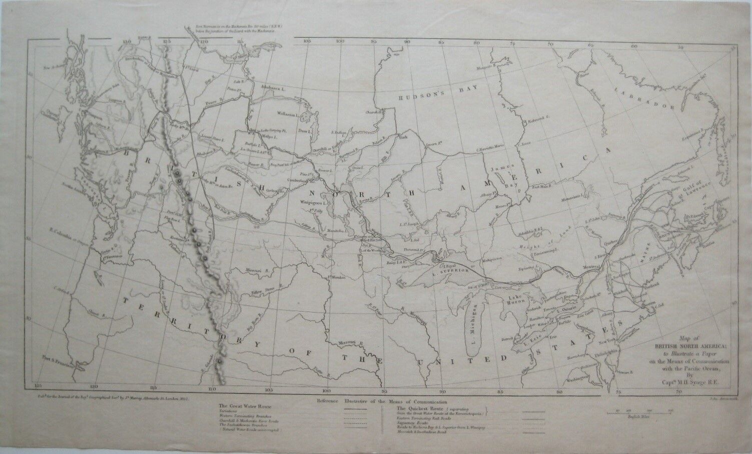
Original 1852 John Arrowsmith Map BRITISH NORTH AMERICA Water Routes Forts Roads:
$249.99
Original1852 antique engraved map showing transcontinental communication routes in British North America, printedmore than 165 years ago. - It is titled Map of British North America to Illustrate a Paper on the Means of Communication with the Pacific Ocean,by Captain M.H. Synge, R.E., drawn by John Arrowsmith.
- The image area measures 17.7 x 35 cm [7\" x 13¾\"]. A legend key in the lower margin identifies the rivers, roads, and railways comprising both \"The Great WaterRoute\" and \"The Quickest Route.\"
- Among the specific named places and features on the map are Fort Simpson,Observatory Inlet, Fraser River, Rocky Mountain House, Great Slave Lake, Hudson\'sBay, Fort Garry or Red River Settlement, Peace River, Cumberland House, Churchill,James Bay, Fort Pelly, and the La Loche Carrying Place, one of themost important portages in the fur trade route across Canada.
- The map was published for the Journal of the Royal Geographical Society by JohnMurray, Albemarle Street, London, 1852.
- Condition: This map is in excellent condition, bright and clean,with no marks, rips, or tears. It is blank on the back, with no printing on thereverse side. Please see the scans and feelfree to ask any questions.
- This is an original, authentic antique map, nota reproduction or modern reprint, and it is fully guaranteed to begenuine. It would make a very handsome display in your den or office.It would also make a perfect gift, and we\'ll include our helpfulframing tips for your reference.
- John Arrowsmith (1790-1873) was a noted map engraver, publisher, geographer, cartographer, and a founding member ofthe Royal Geographical Society.
- Millington Henry Synge (1823-1907), a captain in the Royal Engineers,was the author of the paper presented to the Royal Geographical Society describing a transportation system — a hybrid of railways and canals — that would stretch from the Gulf of St. Lawrence to the Pacific Ocean, as shown on this map. Captain Synge\'s paper was titledProposal for a Rapid Communication with the Pacific and the East, via BritishNorth America.
- Buy with confidence! We are always happy to combine shipping on thepurchase of multiple items — just make sure to pay for everythingat one time, not individually.
Powered by SixBit\'s eCommerce Solution 
|