
When you click on links to various merchants on this site and make a purchase, this can result in this site earning a commission. Affiliate programs and affiliations include, but are not limited to, the eBay Partner Network.

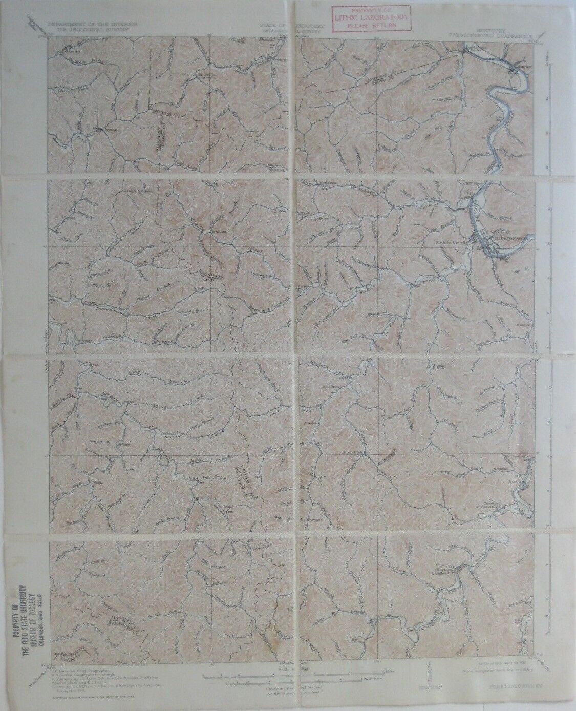
Original 1918 USGS Topo Map PRESTONBURG Kentucky Cliff Mine Big Sandy Railroad:
$22.99
Genuineoriginal color lithographed fold-out dissected topographical map ofparts of Floyd, Johnson, and Magoffin counties,printedmore than88years ago. - The map is drawn on a scaleof 1:62,500, with contourlines at 20-footintervals, and shows roads, towns, railroads,andnatural features,as well as individual housesandfarms!
- The coverage area is bounded by longitude 82°45\' W to83°00\' Wand latitude37°30\' N to 37°45\' N.
- Among the named places andfeatures on the map are Maytown, Licking River, Ivyton, Middle Creek,the Chesapeake & Ohio Railroad, Riceville, Sherman, BearHollow,Bonanza, Brainard, East Point, Pigpen Branch of Puncheon Camp Creek,the Big Sandy & Kentucky River Railroad,Guypsy, Cliff Mine, Smalley, Gapville, Auxier, Ordway, Alum Lick, Martin,andtiny portions of Breathitt and Knott Counties.
- The map was published by theU.S. Geological Survey,Department of the Interior. It is identified as the 1918edition ofthe Prestonburgquadrangle, based on surveys in 1915 and printed in 1932.
- It is an original, authentic USGS topographic map, nota reproduction or modern reprint, and it is fully guaranteed to begenuine. Overall size is approximately 21\" x 17\".
- What gives this map an extra touch of charm is that ithas beendissected and mounted on linen — to facilitate use of the map duringresearch, so the folds would not wear when the map was opened andclosed.
- The dissection and mounting were done in a careful andprofessional manner for the Lithic Laboratory in Columbus, Ohio.
- The Lithic Laboratory was established in January 1938 bythe OhioHistorical Society for the study of stone tools and flint making byNative Americans in the eastern United States. The laboratory was tofunction for only a few years, being discontinued on the eve of WorldWar Two, but it played a critical role in the history of modernstone-tool studies.
- The images show thedissection, which leaves a gutter of space between the panels. Notethatthere is no missing information; the paper map was neatly cut intopieces and the pieces were slid slightly apart and mounted on linen.
- The linen used for mounting the map has a soft cottonyfeel, furtheradding to the map\'s charm. It is a delight to hold it in your hands.
- The map has beenfolded to approximately 8½\" x 5½\" and has a handwritten title on theverso, or reverse side, preserved with a slight brushing ofvarnish.
- Condition: It is in very goodcondition, with no ripsor tears. It is an ex-library map, andthere are old library markingsin the margins. Please seethe scansand feelfree to ask any questions.
- Buy with confidence! We are always happy to combineshipping on thepurchase of multiple items — just make sure to pay for everythingat one time, not by SixBit\'s eCommerce Solution

|