When you click on links to various merchants on this site and make a purchase, this can result in this site earning a commission. Affiliate programs and affiliations include, but are not limited to, the eBay Partner Network.
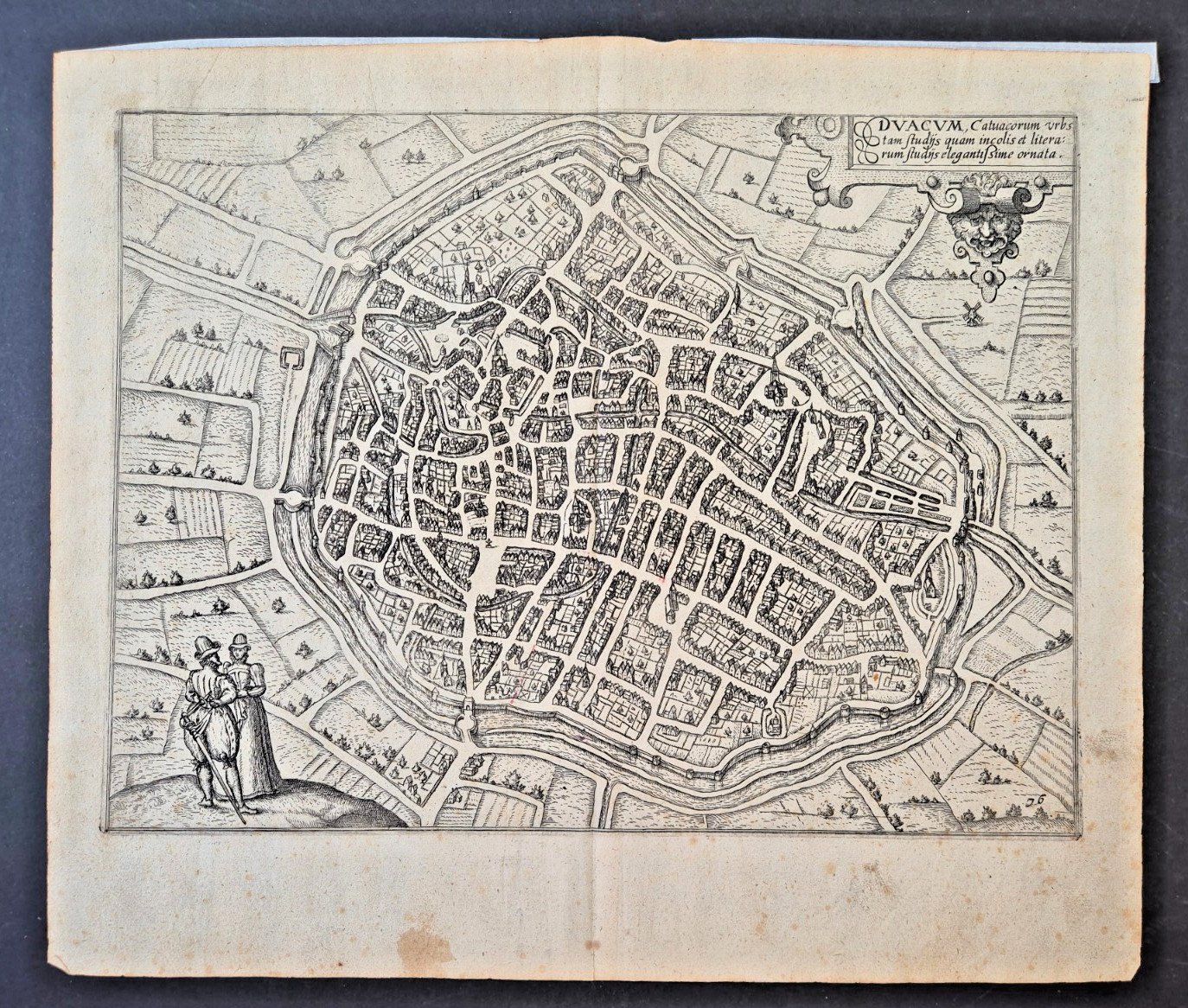
Original antique engraved map of Douai (Duacum), France, from the celebrated Civitates Orbis Terrarum by Georg Braun and Frans Hogenberg, published in the late 16th / early 17th century.
The title cartouche reads:
\"DVACVM, Catuacorum urbs, tam sudhis quam incolis et literarum studiis elegantissime ornata.\"
This is an original copper engraving on laid paper with a visible plate mark and the original center fold, as issued in the atlas.
Details
Title: DVACVM (Douai, France)Engravers: Frans Hogenberg (after Georg Braun)Publication: Civitates Orbis TerrarumDate: late 16th / early 17th centuryTechnique: Original copper engravingPaper: Laid paperSheet size: approx. 35 × 30 cm (13.8 × 11.8 in)
Condition
Good antique condition.
Strong, well-printed impression.Original center fold as issued.Light age toning and scattered foxing.Small old paper reinforcements to the left margin.Minor edge wear and handling marks consistent with age.Please examine all photographs carefully, as they form part of the description.
A genuine Renaissance city map from one of the most important town atlases ever published.
The item will be carefully packed and shipped flat.
Item specifics
Type: Antique MapCity: Douai (Duacum)Country: FranceCartographer: Georg Braun & Frans HogenbergPublication: Civitates Orbis TerrarumDate: c. 1575–1618Original/Reproduction: OriginalPrinting Technique: Copper EngravingPaper: Laid PaperSheet Size: 35 × 30 cmLanguage: Latin