When you click on links to various merchants on this site and make a purchase, this can result in this site earning a commission. Affiliate programs and affiliations include, but are not limited to, the eBay Partner Network.
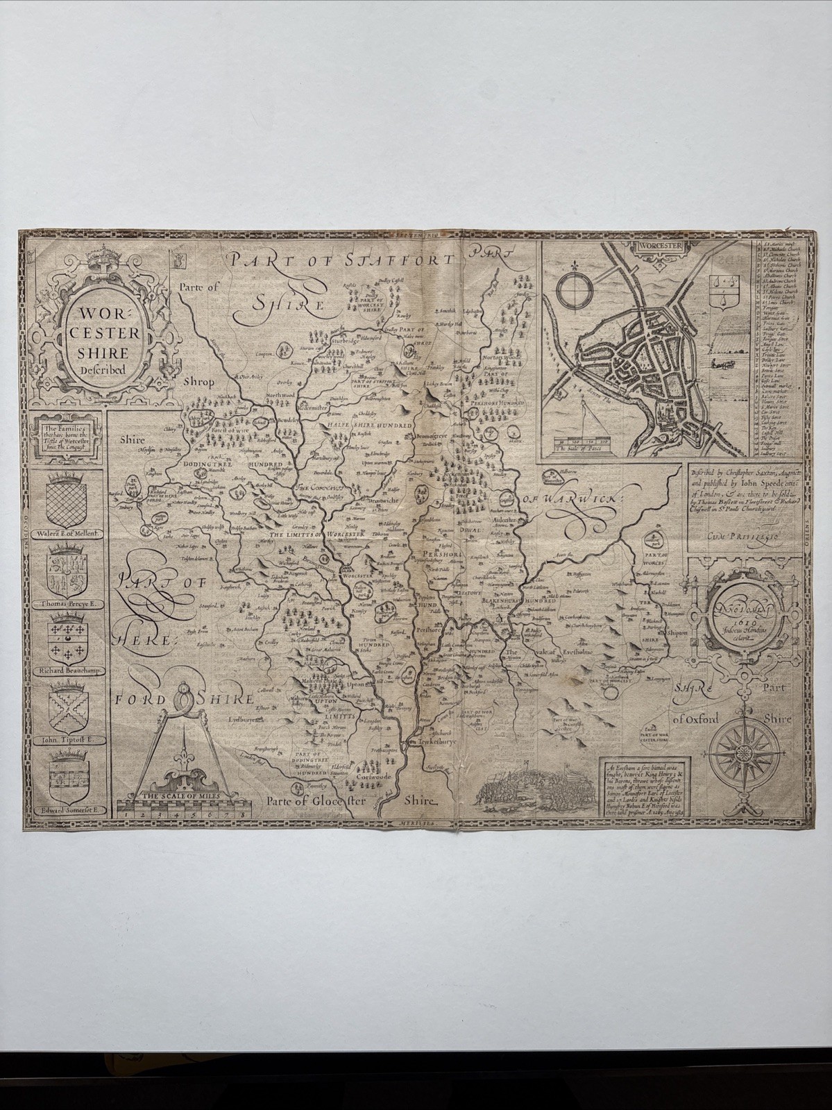
This is a historical map of Worcestershire, England, created by the English cartographer and historian John Speed.
The map, titled "Worcestershire Described," was published in 1610 as part of Speed's atlas, "The Theatre of the Empire of Great Britaine".
It was engraved by Jodocus Hondius and originally published by Thomas Bassett and Richard Chiswell.
The map shows the county of Worcestershire and includes an inset town plan of the city of Worcester.
It is a detailed work that also features heraldic coats of arms
Size : 39x50 cm
“Thank you for exploring our beautiful collection of antique engravings! Our original pieces span the 17th, 18th, and 19th centuries, covering a wide array of styles and periods, from the Renaissance and Baroque to the Neoclassical and Victorian eras. Our collection includes engravings of noble and important historical figures, as well as royalty and aristocratic themes, alongside landscapes, architectural works, and nature scenes. Many of these engravings have counterparts in the collections of the British Museum and the National Portrait Gallery in London. We invite you to explore our shop and discover more treasures to add to your collection!”