When you click on links to various merchants on this site and make a purchase, this can result in this site earning a commission. Affiliate programs and affiliations include, but are not limited to, the eBay Partner Network.
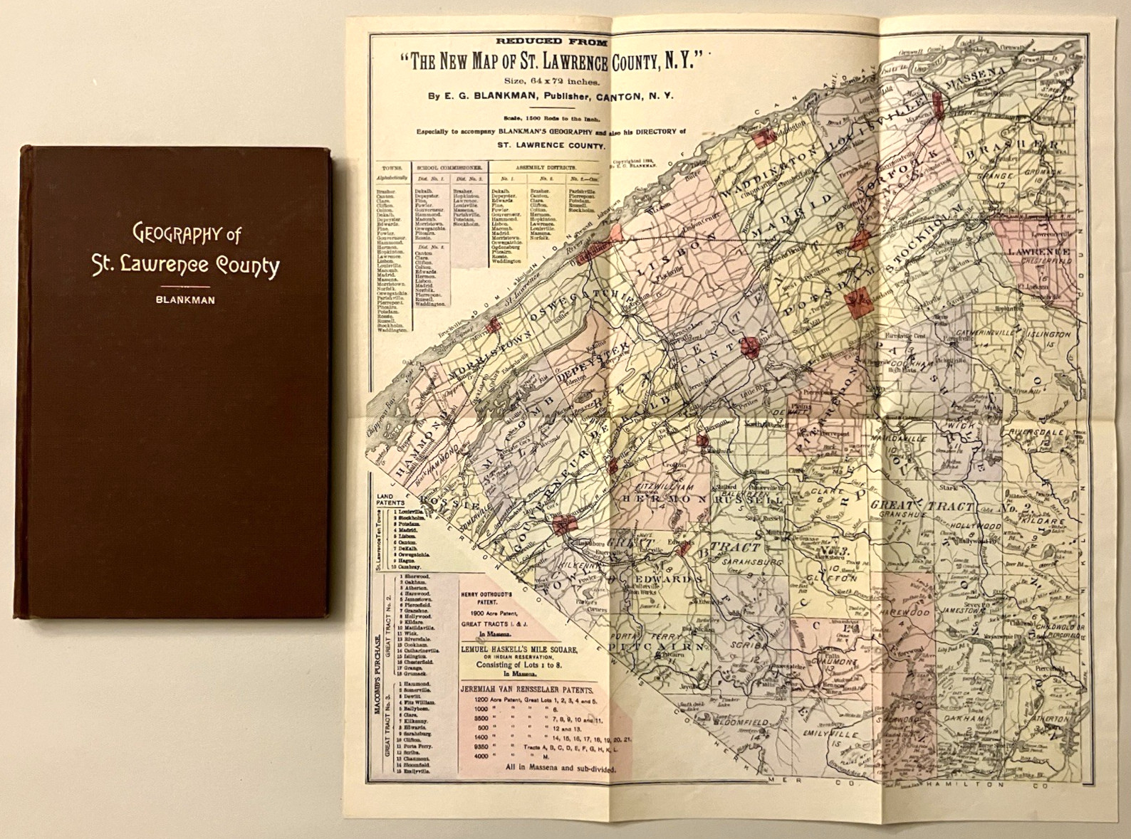
Geography of St. Lawrence County with Map, prepared for use in public schools, by Edgar G. Blankman. The map is laid-in, and is a reduced version of Blankman\'s map from one year prior titled The New Map of St. Lawrence County. The map is in color and measures 14 x 14.5 inches.
1898, First Edition. Published in Canton, New York by the Plaindealer Press.
Hardcover, original cloth, gilt title. 126 pp., plus index. Illustrated throughout with a handcolored map as well as drawings and photos.
This book and map were owned by notable St. Lawrence citizen Edward H. Neary Neary\'s signature is on the title page in ink, and on the back of the map in pencil.
Map in very good condition, folded as issued, with a couple of tiny tears at the edges and a few stray pencil marks. The book is in good condition. The text is clean, bright and unmarked; the covers are in good shape with light rubbing and some light wear to the spine ends. The inner hinges are both cracked in places and a bit loose. As is, the book can be handled and read, but it should probably be professionally restored at some point.
A rare book. As far as I can tell this is the only copy for sale anywhere online.