When you click on links to various merchants on this site and make a purchase, this can result in this site earning a commission. Affiliate programs and affiliations include, but are not limited to, the eBay Partner Network.
Stunning European Continent Wall Map - Perfect for Home, Office, or Classroom Display
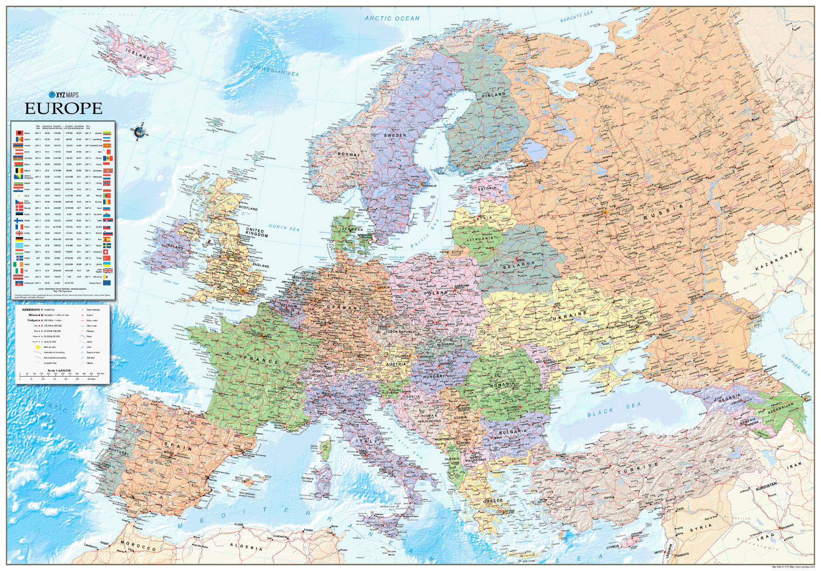
This European Continent Wall Map is a visually striking and information-rich resource, to bring Europe’s political and physical geography to life.
Map Details:
Size: 125cm x 87cm
Scale: 1:4,600,000
Map Features:
Clear Political Boundaries, each European nation is distinguished with vivid political colouring, making borders easy to identify and countries instantly recognizable.
Digital Hill and Sea Shading, realistic shading brings Europe’s varied landscape to life, accentuating mountain ranges, valleys, and bodies of water for a natural, three-dimensional effect.
Informative Inset Panel, conveniently located, this panel includes updated country flags, latest population estimates (sourced from the UN Population Unit), and international dialling codes, offering a quick reference to important data.
Geographic and Physical Labels, Countries are labelled alongside notable oceans, seas, bays, capes, deserts, and mountains, giving a comprehensive view of Europe’s physical geography.
Capitals, major cities, mountain summits, main roads, railways, rivers, and international boundaries are clearly marked.
Whether used as an engaging learning tool in a classroom, a reference piece in an office, or a decorative centrepiece at home, this map’s high-quality design and detailed information make it a timeless and functional addition to any wall.
MAPS ARE PRINTED FLAT, ROLLED INTO PLASTIC SLEEVES AND PLACED IN CARDBOARD TUBES FOR DELIVERY.