When you click on links to various merchants on this site and make a purchase, this can result in this site earning a commission. Affiliate programs and affiliations include, but are not limited to, the eBay Partner Network.
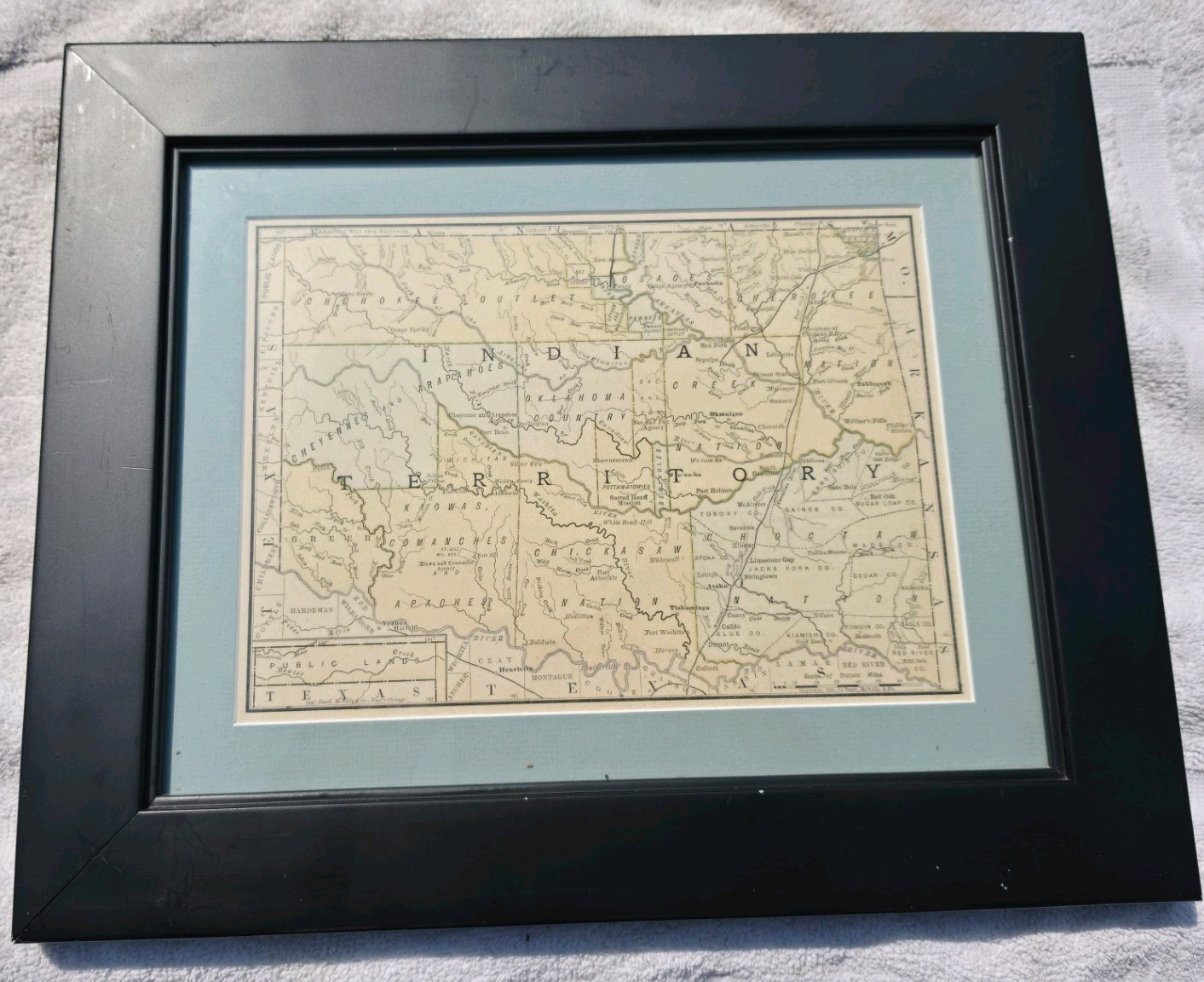
Original antique 1885 Rand McNally & Co. atlas map depicting Indian Territory before Oklahoma became a state. This authentic map was originally published in 1885 and professionally matted and framed under glass, making it an outstanding display piece for collectors of Western Americana, Native American history, Oklahoma history, and antique cartography.The map illustrates Indian Territory with remarkable detail, including the lands of the Cherokee, Choctaw, Chickasaw, Creek, Seminole, Osage, Cheyenne, Arapaho, Kiowa, Comanche, Apache, and numerous other tribal nations. Early railroads, rivers, military posts, settlements, and territorial boundaries are all clearly shown.Published by the renowned Rand McNally & Company of Chicago, this map dates to a pivotal period in American history more than two decades before Oklahoma achieved statehood in 1907. Original atlas fold lines are present, which is typical and expected for maps removed from nineteenth century atlases.Condition is very good for its age. The map displays attractive age toning consistent with a piece over 140 years old. It is professionally matted and framed and ready for display. Please review all photographs carefully as they are part of the description.Features:
• Original 1885 Rand McNally atlas map
• Copyright dated 1885
• Indian Territory prior to Oklahoma statehood
• Professionally matted and framed
• Excellent detail including tribal lands, rivers, railroads, military posts, and early settlements
• Ready to display
• A wonderful addition to any collection of antique maps, Western Americana, Native American history, or Oklahoma historyThe framed item shown is the exact piece you will receive.