When you click on links to various merchants on this site and make a purchase, this can result in this site earning a commission. Affiliate programs and affiliations include, but are not limited to, the eBay Partner Network.
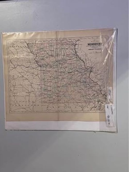
Step back in time with this original antique 1885 hand-colored Map of Missouri, a remarkable piece of American cartographic history. Drawn and engraved on copper plate expressly for Johnson\'s Cyclopaedia, this map showcases Missouri in stunning detail, featuring county boundaries, towns, rivers, and major roads of the era. The hand-applied coloring gives each region a distinctive, warm aesthetic that is impossible to replicate with modern printing techniques. Neighboring states and territories, including Kansas, Nebraska, Arkansas, and the Indian Territory, are also visible along the borders, providing rich historical context. Measuring 11 inches wide and 14 inches tall, this map is an ideal size for framing and displaying in a home, office, or study. The aged paper lends an authentic charm that collectors and history enthusiasts will truly appreciate. Currently stored in a protective plastic sleeve to help preserve its condition, this one-of-a-kind antique artifact is a wonderful addition to any map or Americana collection. Do not miss your chance to own a genuine piece of 19th-century American history.