When you click on links to various merchants on this site and make a purchase, this can result in this site earning a commission. Affiliate programs and affiliations include, but are not limited to, the eBay Partner Network.
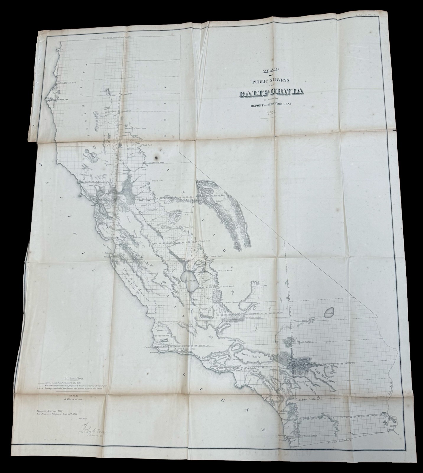
Original 1855 "Map of Public Surveys in California"
To Accompany the Report of the Surveyor General
Offered here is an authentic original 1855 government-issued map titled:
"Map of Public Surveys in California to accompany Report of Surveyor General, 1855."
Prepared by the United States Surveyor General's Office in San Francisco and approved by John Wilson, U.S. Surveyor General, this remarkable large-format map documents the earliest years of systematic federal land surveys following California's admission to the Union in 1850.
Issued only a few years after statehood and during the height of the California Gold Rush era, the map represents one of the foundational cartographic records of California's early development under the Public Land Survey System.
It illustrates the extent of completed federal township and range surveys while identifying areas still awaiting survey, providing an extraordinary snapshot of California during one of the most transformative periods in its history.
Among the features shown are:
- Early federal township and range surveys
- Public Land Survey System (PLSS) grid
- Rivers, lakes, and coastal features
- Mountain ranges
- Mexican Boundary
- Major bays and waterways
- Islands
- Surveyed and unsurveyed lands
- Early settlements and geographic features
Government survey progress through 1855;
Unlike decorative commercial maps of the period, this is an important working government document illustrating the expansion of federal land administration across California during the state's formative years.
Its historical significance extends to collectors of:
- California history
- Western Americana
- Gold Rush history
- Government publications
- Public Land Survey System (PLSS)
- Land office records
- Early American cartography
Condition:
The map remains complete with no missing sections or areas of loss, an important consideration for large folding government maps of this period.
It retains its original folds as issued and exhibits the honest signs of age expected of a paper artifact approaching 170 years old.
The reverse has undergone professional archival stabilization, with conservation-grade tissue reinforcing several fold separations and stress points. These unobtrusive archival repairs were performed to stabilize vulnerable areas created by repeated folding over many decades and to help ensure the map's continued preservation. The conservation work remains confined primarily to the reverse and has preserved the map's excellent display qualities while maintaining its historical integrity.
Additional condition notes:
- Original folding format
- Complete with no missing paper
- Several fold separations professionally stabilized
- Light age toning
- Scattered foxing typical of nineteenth-century paper
- Minor handling wear
- Presents beautifully when fully opened
The map would benefit from professional humidification and flattening if a future owner intends to frame it, but it is already structurally stable and displays well in its current conserved state.
Approximate Dimensions:
37½ x 31 inches
This is a scarce original government map documenting California during its earliest years as a state, produced at the height of westward expansion and the Gold Rush era. Examples of this size and historical importance seldom become available, particularly complete examples that have been professionally stabilized for long-term preservation. It would make an exceptional addition to any collection of early California, Western Americana, Gold Rush history, federal land surveys, or nineteenth-century American cartography.
WILL SHIP CAREFULLY FOLDED