When you click on links to various merchants on this site and make a purchase, this can result in this site earning a commission. Affiliate programs and affiliations include, but are not limited to, the eBay Partner Network.
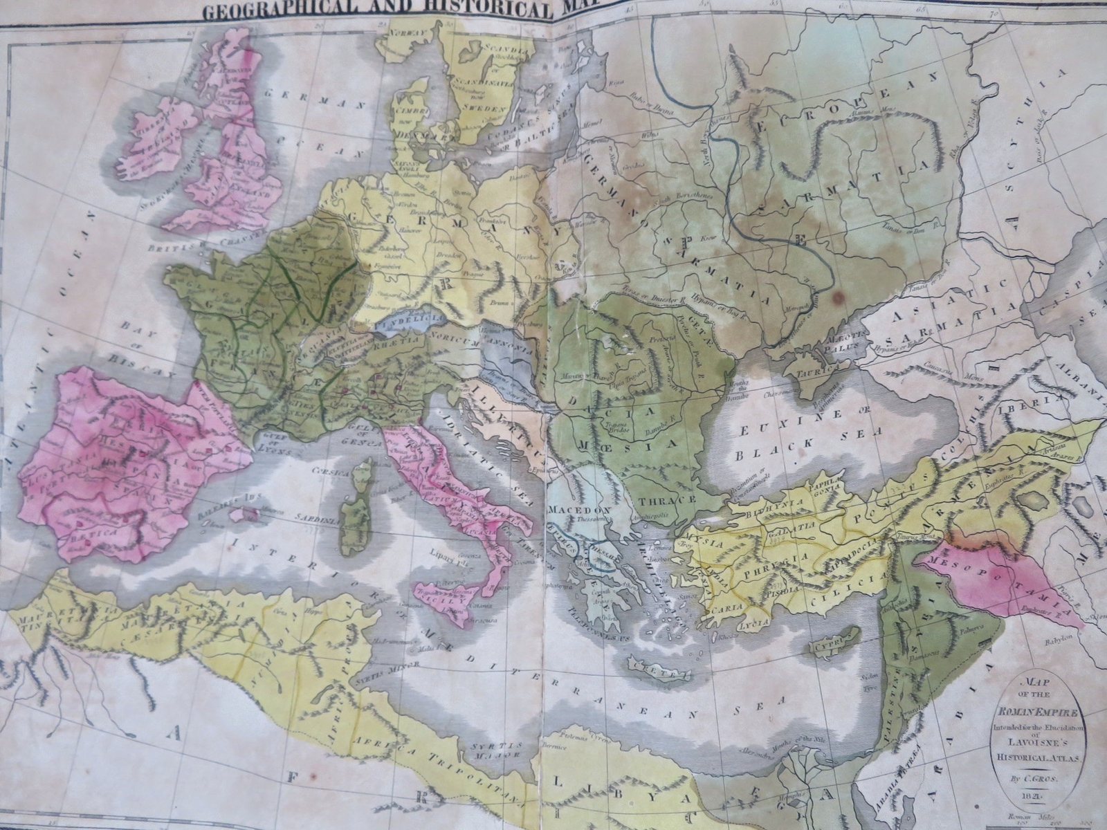
Roman Empire Mediterranean Sea North Africa Gaul Holy Land 1821 Phila. Carey map Roman Empire Mediterranean Sea North Africa Gaul Holy Land 1821 Phila. Carey map
Geographical and Historical Map of the Roman Empire.(Old Maps, 19th Century Maps, Ancient World, Roman Empire, Mediterranean Sea, North Africa, Europe, Hispania, Gaul, Britannia, Italia, Germania, Dacia, Greece, Anatolia, Asia Minor, Egypt, Holy Land, Syria).
Issued 1821, Philadelphia by T.H. Palmer for M. Carey & Sons. Third ed. Engraved by Yeager.
Historically significant early 19th century engraved folio sheet map with original hand color.
Great large map relating to the Roman Empire.
Encyclopedic text relating to the form of government, the population, the increase and expansion of the empire and the Campaigns of Hannibal surrounds map.
Centerfold once split and was backed long ago with a thin cotton fabric tape, remains a nice looking example with pleasing age patina. Moderate age toning, some damp staining & foxing across sheet, top center of sheet slightly more age toned.
Minor c. 1\" edge splits along bottom edge repaired with archival tape.Original centerfold as issued.The heavy paper is somewhat brittle and requires delicate handling. Nice large antique map with a mellowed age patina, looks exactly what you\'d imagine an early 19th century folio sheet map might look like if found sitting in a pile of old papers up in an attic.
Sheet Measures c. 17 1/2\" H x 22\" W.Engraved Area Measures c. 9 1/2\" H x 19\" W.Cartographic Reference(s):
Tooley\'s Dictionary of Mapmakers, vol. 1.[R33959].