When you click on links to various merchants on this site and make a purchase, this can result in this site earning a commission. Affiliate programs and affiliations include, but are not limited to, the eBay Partner Network.
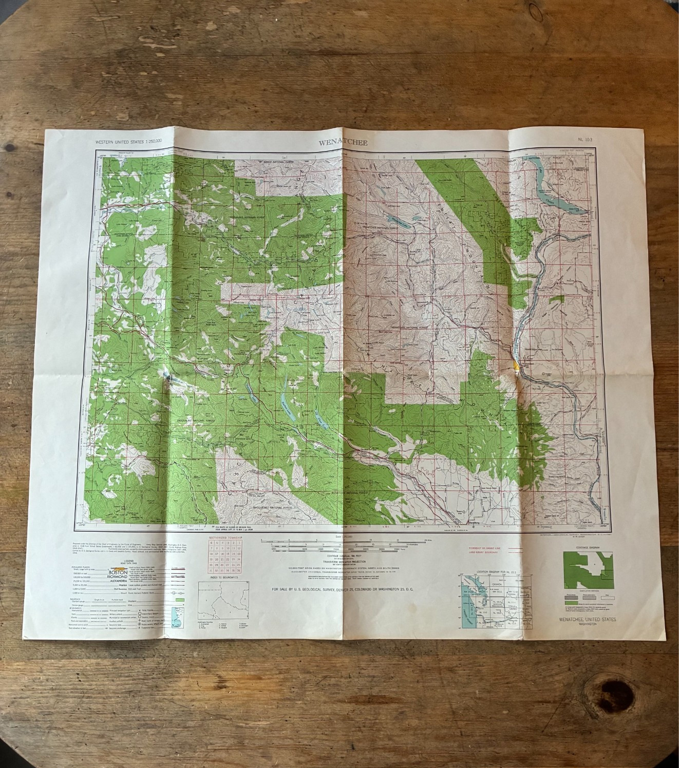
Large-scale colour topographical map at 1:250,000, covering a substantial area of central Washington and the Cascade Mountains.
The map includes Wenatchee, the Columbia River, Wenatchee National Forest, Snoqualmie National Forest, Cle Elum, Ellensburg, Leavenworth and surrounding mountain, forest and river areas. Detailed mapping shows contour lines, roads, railways, rivers, lakes, settlements, mountain peaks, forest boundaries and other geographical features.
Marked “Wenatchee, United States – Washington”, No. 103. The lower margin is printed “Interior—Geological Survey, Washington, D.C.—1961.”
An attractive colour USGS map with particularly detailed coverage of the Cascade mountain and National Forest areas.
Condition: Good vintage condition for its age. Original folding map retaining its original fold lines, with some expected creasing and light age-related edge/corner wear and minor discolouration/marking to the lower margin, visible in the photographs. The printed map itself remains colourful, clear and well preserved. Please study all photographs carefully for condition.
An interesting original period map for collectors of vintage US cartography, Washington State, the Cascade Mountains, National Forests and American travel/history.
Combined postage available when purchasing more than one map – please message before payment.