When you click on links to various merchants on this site and make a purchase, this can result in this site earning a commission. Affiliate programs and affiliations include, but are not limited to, the eBay Partner Network.
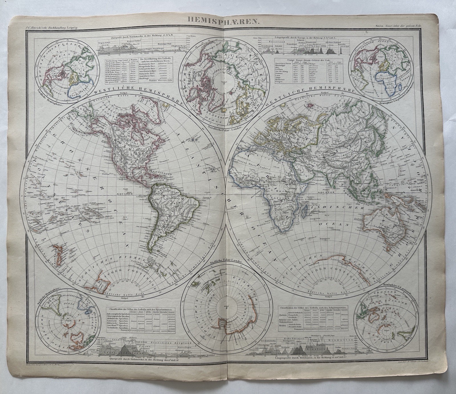
World in hemispheres Mt profiles c.1865 Bruckner Stein scarce antique large map
Hemisphaeren. (World Hemispheres).
c. 1862/64-67, Leipzig by Hinrichs’ for Stein.
Engraved by Schmidt & Eberhardt.
An uncommon mid-19th century large folio sheet map which shows fascinating details unique to this cartographic publisher and historical era.
With comparative mountain profiles across top and bottom, two polar projections along centerfold and four projection globes in the corners.
1.5” centerfold split at bottom edge.
Paper and image remains clean and well preserved with a fine patina and visual appeal.Nice looking example.
Sheet measures c. 17 1/8” x 20 5/8”.
Printed area measures c. 15 5/8” x 19 3/8”.
R36703
Suggested Items
North Pole Arctic w/ explorer Capt. McClure & Kane c.1856 Johnson Fullarton map
$98.00
Celestial Planetary orbits Moon Saturn 1890 Berghaus very detailed Stieler map
$98.00
South Pole explorers routes shown 1890 Petermann very detailed Stieler map
$100.00
North Pole explorers routes shown 1890 Berghaus very detailed Stieler map
$98.00
Pacific Ocean Oceania Polynesia Hawaii Tahiti Fiji 1957 Bartholomew large map
$52.00
World Map Mercator's Projection London 1887-90 Cram scarce large detailed map
$60.00
World in hemispheres 1817 Arrowsmith & Hall uncommon engraved hand color map
$108.00
World Map 1875 North & South Polar projection Mountains of the Moon folio map
$68.00
World North pole projection Asia America Europe c.1810-30’s rare hand color map
$158.40
Mountain heights of Europe comparison vs. Chimborazo diagram c.1820’s rare map
$120.00
World Thematic seas oceans oceanography map c.1810-20’s rare hand color map
$76.00
World Thematic map clothing of peoples nudity c.1810-20’s rare hand color map
$120.00 Powered By 3Dsellers.com - Try for Free!