When you click on links to various merchants on this site and make a purchase, this can result in this site earning a commission. Affiliate programs and affiliations include, but are not limited to, the eBay Partner Network.
15.75 x 18 in.
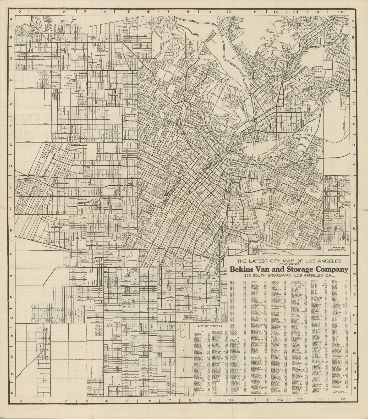
The Latest City Map of Los Angeles Compliments of Bekins Van and Storage Company / The Latest City Map of Los Angeles, Cal. Earth\'s Garden Spot Population 500,000.
This is a scarce c. 1915 folding map of Los Angeles produced by Bekins Van and Storage. It presents the city surrounded by an alphanumeric grid that corresponds to an index of street names at bottom-right and continues on the verso. Streets are labelled on the map along with railroad lines, waterways, and the locations of Bekins offices and facilities. It includes interesting features, including short-lived locations like the Ascot Park Speedway in the Florence neighborhood of South L.A. Parts of the city remain undeveloped here, but they shortly would be filled in, as L.A.\'s population nearly doubled between 1910 and 1920, no doubt a boon for Bekins.
A map with this title was published for many years by Bekins, but as they are undated other details, such as the population statistic given, have to be used to estimate a date. This is certainly among the earlier and rarer editions; we only are able to confirm one in institutional collections, held by the Huntington Library.