When you click on links to various merchants on this site and make a purchase, this can result in this site earning a commission. Affiliate programs and affiliations include, but are not limited to, the eBay Partner Network.

1951 US Army Korean War Topo Map YANGDOK Roads P'yŏngwŏn Railway Line Ski Resort:
$49.99
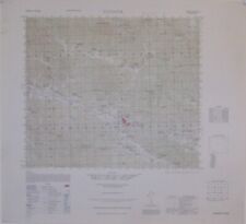
Original 1951 color lithographed topographical map of Yangdok andvicinity in P'yongwon Countypreparedbythe Army MapService, Corps of Engineers, U.S. Army, Washington, D.C. during theKoreanWar, more than 70years ago. - The coverage area is boundedby longitude126°30'10.4" Eto 126°45'10.4" Eand latitude 39°10' N to 39°20' N.
- The map is drawn on a scaleof 1:50,000, and the image areameasures 37 x 43.4 cm [14½" x 17"], on a sheet measuring 22" x 24".
- The map is titled Yangdok, Korea,andis identified as Sheet 6531 IV, printed by ArmyMapService, Corps of Engineers, 7-51.
- There arenumerous named places and features, including roads, railways,towns, villages, natural features, spotelevations, andcontours, at intervals of 10meters.
- In October 1950 Yangdok was along the approach line fromthe east toward Pyongyang bythe 6th and 8th ROK Divisions, part of the flanking operationoriginally conceived by UN commander General Douglas MacArthur for US XCorps after it had landed on the east coast at Wonsan.
- In the summer of 1951, around the time this map wasprinted, the USAF’s 3rd Bomb Wing, based at Kunsan, was engaged in aninterdiction campaignin the Yangdok area as part of Operation Strangle.
- Condition: This map is in excellentcondition,bright and clean, with norips, tears, or writing. It is blank on the back, with no printingon the reverse side.Please see thescansand feelfree to ask any questions.
- The map has never been folded, and we will ship it to youcarefully rolled in a sturdycardboard tube.
- This is an original, authentic 1951 map, nota reproduction or modern reprint, and it is fully guaranteed to begenuine.
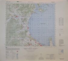
- We may also have a nice companion to this map availableinourstore — a 1951 US Army topo map published during the Blockade ofWonsan. It islisted asitem # 224477479316. If you'd like to take a look,simply click here.
- Today, Yangdok is home to a hot springs spa complex inthe mountains of South P'yongan province, a couple of hours' drive fromNorth Korea's capital city. It hasindoor and outdoor baths, a ski slope, and a horse-riding park, builton the site of Yangdok Recreation Center which had opened in 1947. TheP'yongwon Lineis today the P'yongra Railroad Line, an electrified standard-gauge trunk line ofthe Korean State Railway in North Korea.
- Buy with confidence! We are always happy to combineshipping on thepurchase of multiple items — just make sure to pay for everythingat one time, not individually.
Powered by SixBit's eCommerce Solution
|