When you click on links to various merchants on this site and make a purchase, this can result in this site earning a commission. Affiliate programs and affiliations include, but are not limited to, the eBay Partner Network.
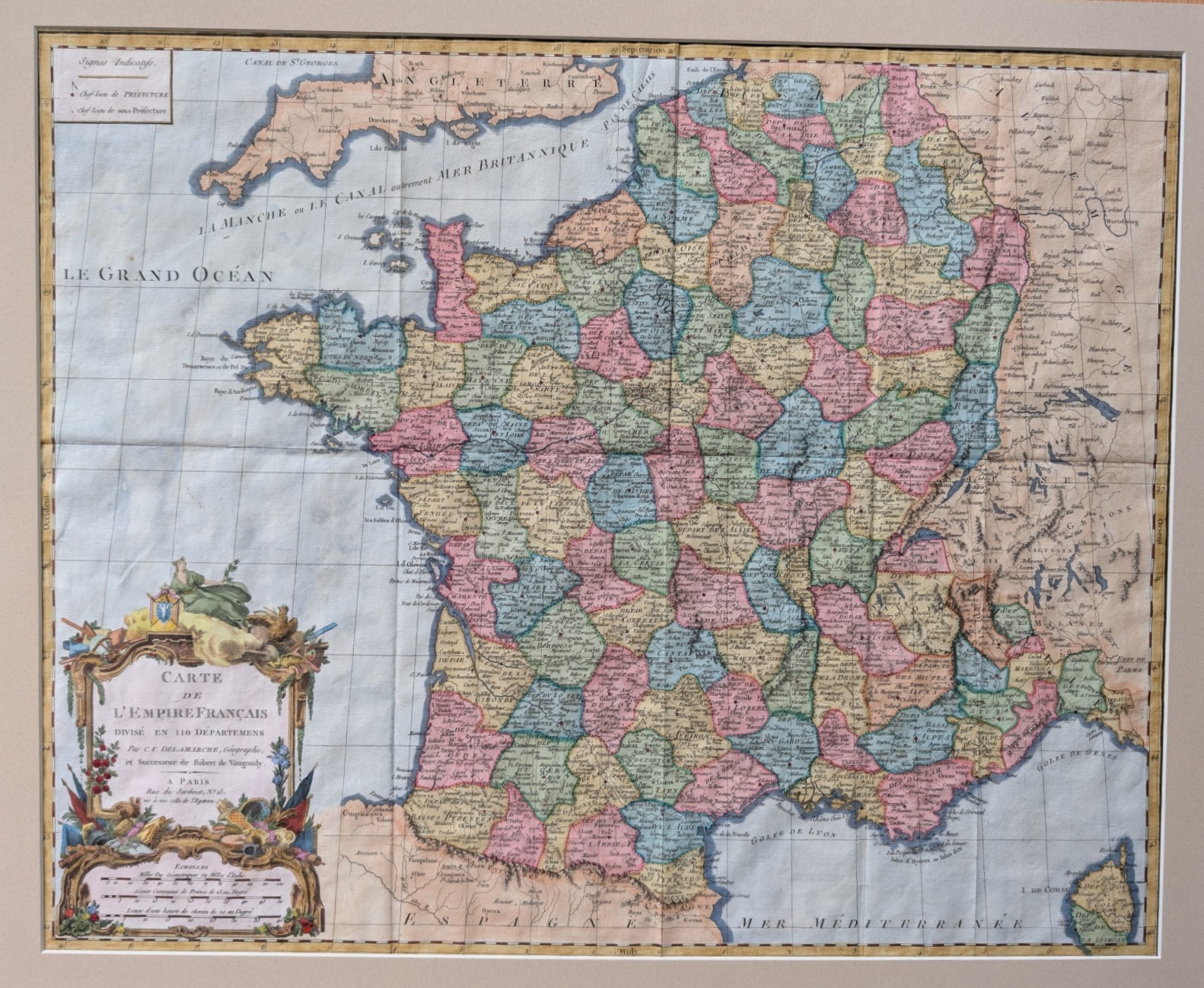
A hand-colored engraved map titled \"Carte de l\'Empire Français, divisé en 110 Départements\" (Map of the French Empire, divided into 110 Departments), created by C.F. Delamarche, Paris-based geographer and successor to Robert de Vaugondy, circa 1804 — the year Napoleon crowned himself Emperor and established the First French Empire.
The map depicts France\'s full post-Revolutionary departmental structure, with each of the 110 departments hand-tinted in soft period colors (rose, green, blue, gold) for easy visual distinction. It includes portions of neighboring England, the Channel Islands, and the western Mediterranean coast, along with a distance scale and signs/legend key in the upper left. The lower left corner features an elaborate allegorical title cartouche with classical figures, florals, and decorative flourishes typical of fine French cartography of the period.
The lower left corner features an elaborate allegorical title cartouche, and the hand-coloring here is exceptional — finer and more fully realized than typically seen on maps of this type. The allegorical figure\'s drapery is shaded and modeled rather than flat-washed, individual feather details are picked out on the rooster (a Gallic emblem fitting for a map of the French Empire), and the floral garlands carry multiple distinct colors rather than a limited period palette. Even secondary decorative elements — the scale bar surround, ribbon work, and trophy details — have been carefully colored rather than left plain. This level of coloring attention significantly elevates the piece above typically-encountered examples of period French departmental maps.
Provenance: This example was acquired from a specialist American antiquarian map dealer, whose own catalog description called it \"a very scarce map, issued during Napoleon\'s short-lived French [Empire/Republic]\", in \"VG+ antiquarian condition.\" Original dealer documentation, including the item\'s catalog page and purchase receipt, is included with this sale.
Size: Sheet 25⅛\" x 19⅝\"; image 23½\" x 19⅛\" per dealer\'s original measurements.
Condition: Please review all photos closely. Map is very close to condition as described when purchased and framed in 2004: \"In VG+ antiquarian condition\"