Heat.net Store Home
|
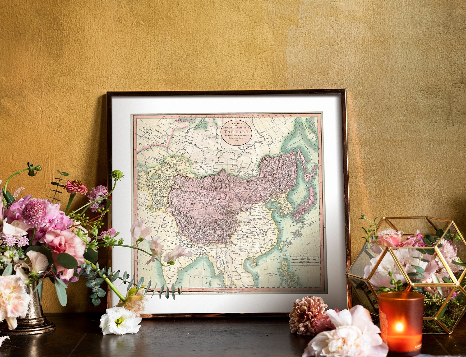
1806 Map Tartary Central Asia Mongolia Tartaria Tartarie Wall Art Poster Print For Sale

When you click on links to various merchants on this site and make a purchase, this can result in this site earning a commission. Affiliate programs and affiliations include, but are not limited to, the eBay Partner Network.

1806 Map Tartary Central Asia Mongolia Tartaria Tartarie Wall Art Poster Print:
$13.95
1806John CaryMap of Mongolian & Independent Tartary.
-See more info below- This is a modernUNFRAMEDreproduction of the original map -Frames areNOTIncluded The Images Shown is for Illustration Purposes Only. This Map Comes in Sizes: 11\"x12\", 16\"x17.5\" and 23\"x25\" You can find them and moreMaps of Asiain
Our Store Remember,the smaller the map size, the smaller the print, that means it is harder to read the text! All Our Posters and Maps Are Made in the USA Tartary was a historical term used in European literature and cartography to refer to a vast, largely unknown region in Asia, encompassing areas like Siberia, Mongolia, and parts of China. Essentially, it was a placeholder for a vast, undefined area of Central and East Asia that was not well-understood by Europeans before the 18th century.The name \"Tartary\" and the people called \"Tartars\" were associated with the Mongols and Turkic peoples under Mongol rule. - Printed on premium 36lb matte paper with fade resistant archival inks andincludes a white border on all sidesto allow for matting and framing.
- Please note that there may be some variation in the color of the on-screen image and the actual item received. This is subject to the brightness and contrast of your screen settings.
- This is a modern UNFRAMED reproduction of the original print - Frames are NOT are the prints shipped?They are rolled and placed into a rigid tube or box.
-Is this available in a larger/smaller size.For smaller or larger sizes, email us.
An exceptionally beautiful example of John Cary’s important 1806 map of Mongolian and Independent Tartary. Covers Central Asia from the Caspian Sea to Japan, extends as far north as the Obskaia Sea and as far south as India, Burma and the Philippines. Includes the modern day nations of Uzbekistan, Kazakhstan, Turkmenistan, Kirgizstan, Tajikistan and Mongolia. One of Cary’s most interesting maps. Central Asia, despite hundreds of years of passing trade on the Silk Routes, was still, at the turn of the century a largely unknown land. Cary attempts to show some of the Silk Route passages, especially to the north of the Gobi, but ultimately admits, “The Geography of these parts is extremely obscure.” All in all, one of the most interesting and few maps of Central Asia to appear in first years of the 19th century. Prepared in 1806 by John Cary for issue in his magnificent 1808 New Universal Atlas. (NOTE: The reproduction of the colors in this map appear to be incorrect, as Japan and Tibet were never part of Chinese Tartary yet appear to be the same color as it.) Also depicted: Willow Palisade, Great Wall of China, Staten Island (Pacific)
|
|
Other Related Items:
Related Items:
1806 Map Tartary Central Asia Mongolia Tartaria Tartarie Wall Art Poster Print $21.95
1806 MAP OF SPAIN antique engraved 11"x 16" vellum IBERIAN PENINSULA, ROMAN $39.99
1806 CADELL AND DAVIES ATLAS MAP, "IRELAND" $20.00
|
