When you click on links to various merchants on this site and make a purchase, this can result in this site earning a commission. Affiliate programs and affiliations include, but are not limited to, the eBay Partner Network.
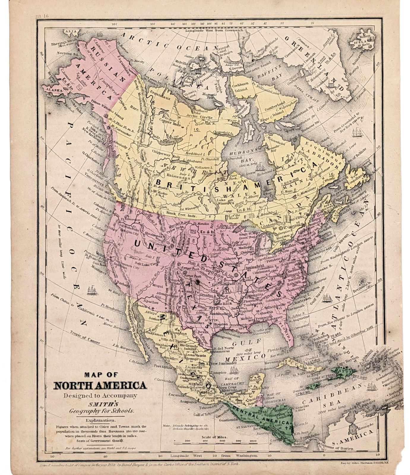
RARE AND EARLY ORIGINAL 1857 ANTIQUE MAP OF NORTH AMERICA WITH STOVE PIPE TEXAS
DATED - 1853, PUBLISHED IN 1857
PUBLISHED BY - DANIEL BURGESS
ORIGINAL 1857 ANTIQUE HAND-COLORED NORTH AMERICA MAP. EARLY AND IMPORTANT NORTH AMERICA MAP SHOWING POLITICAL BORDERS, STOVE PIPE TEXAS, WEST INDIES, RUSSIAN ALASKA, BRITISH AMERICA, MEXICO AND PART OF SOUTH AMERICA. ALSO SHOWN ARE TOWNSHIPS, WATERWAYS AND POPULATION NUMBERS.
GOOD CONDITION, DISCOLORATION AND STAINING
MEASURES 10.5 X 8.25 INCHES