When you click on links to various merchants on this site and make a purchase, this can result in this site earning a commission. Affiliate programs and affiliations include, but are not limited to, the eBay Partner Network.
# Antique 1899 Northwestern Yeast Co. Promotional Map Booklet
### Complete Set of 3 Fold-Out Maps Intact - Spanish-American War Era Advertising Ephemera
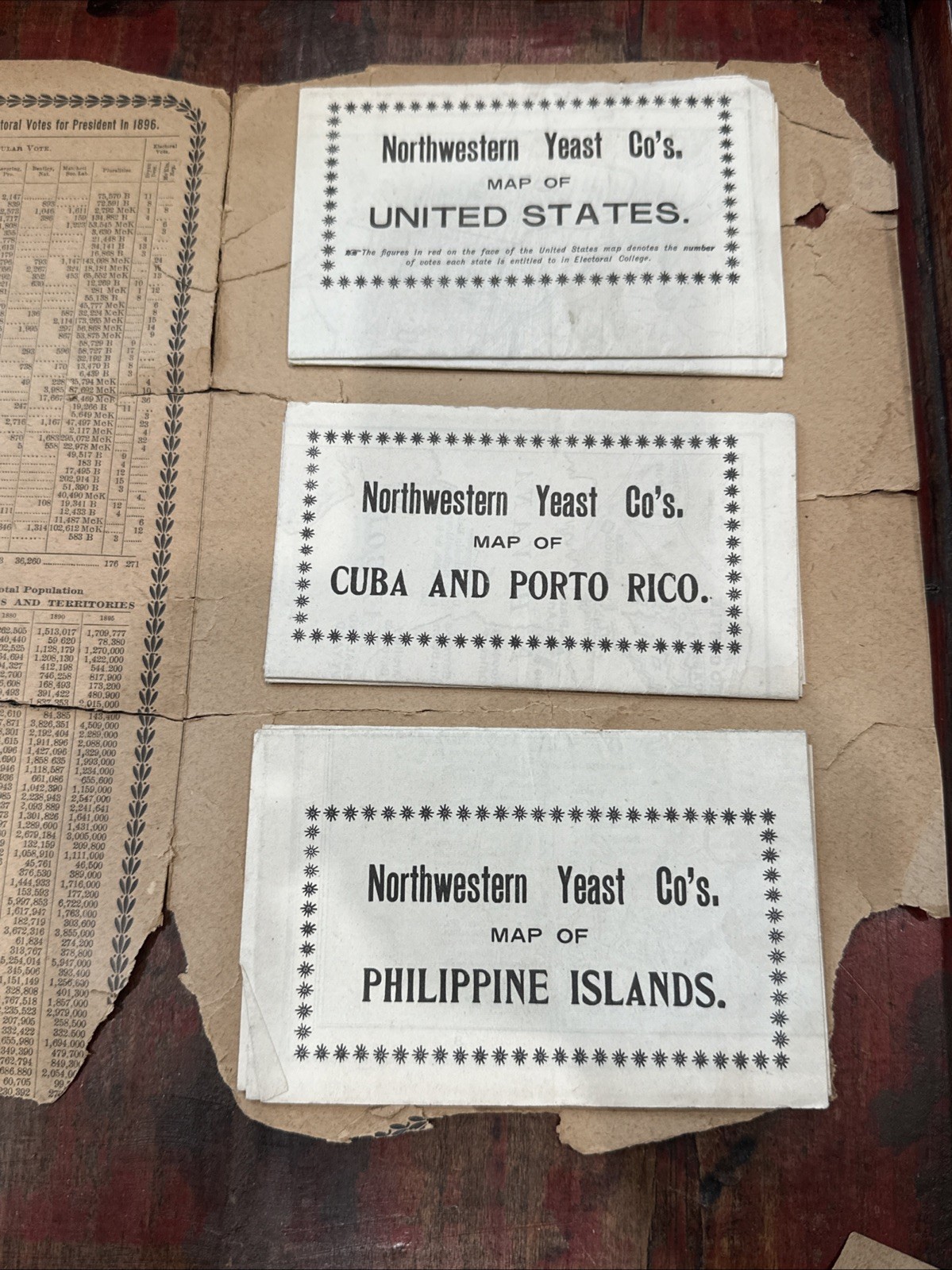
This is a fascinating piece of late 19th-century American cartographic and advertising history. This 1899 promotional booklet, issued by the **Northwestern Yeast Company** of Chicago, Illinois, was printed following the conclusion of the Spanish-American War to showcase newly acquired U.S. island territories.
While the outer cover exhibits heavy wear, **all three interior fold-out maps are completely present and physically attached to the binding.**
---
### 🗺️ Included Map Contents
* **Map 1: Map of the United States** - Features overprinted historical statistics tracking the electoral votes cast during the 1892 and 1896 presidential elections. Includes an inset map of Alaska.
* **Map 2: Map of Cuba and Porto Rico** - Custom-drawn by renowned map designers Eugenia Wheeler Goff and Henry Slade Goff. Includes unique sidebar chronologies logging the definitive battles and timeline of the Spanish-American War.
* **Map 3: Map of the Philippine Islands** - Full regional breakdown of the newly acquired territory.
* **Flap Text:** Includes the full "Valuable Statistics" tables mapping out global gold production (1890–1898), the impacts of the Dingley Tariff, and detailed 1897 U.S. Treasury currency data.
---
## ⚠️ Detailed Condition Report
This piece is being sold **As-Is** with an explicit focus on the surviving maps.
**Philippine Islands Map Crease:** The individual "Philippine Islands" map fold-out packet shows a small, minor split starting at the outer edge of its main crease line (visible in the close-up photo). It is non-structural, the fold remains fully intact and attached.
* **The Cover:** The 125+ year-old wood-pulp cover is highly fragile and literally falling apart. The front cover section shows severe edge chipping and heavy paper loss along the right margin.
* **The Flap:** The interior "Valuable Statistics" page has fully detached/torn away clean along its vertical crease line (the separated page is physically included in full).
* **The Maps:** The internal white-stock fold-out maps are the highlight of this item. The printed faces remain surprisingly clean and bright, though the paper handles with the expected fragility of its age.
*Please review all listing photographs closely—especially the close-up of the seam tear—to assess the precise edges, folds, and splits prior to placing your offer.*
*Please review all listing photographs closely to assess the precise edges, folds, and seam splits prior to purchasing