When you click on links to various merchants on this site and make a purchase, this can result in this site earning a commission. Affiliate programs and affiliations include, but are not limited to, the eBay Partner Network.
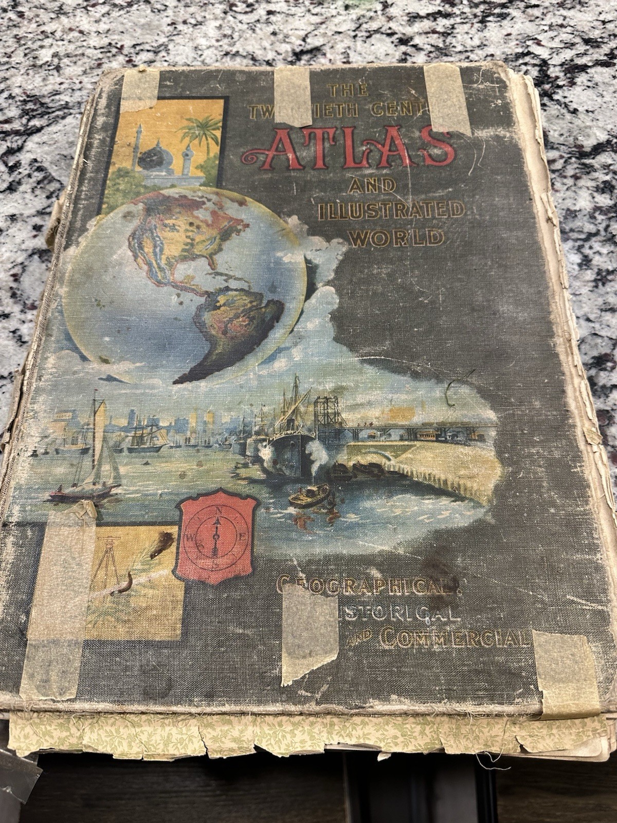
This is a piece of history very rare atlas world book! It is in rough shape as shown in pictures. the pages are still readable for 125!! Years seems great. Antique “Twentieth Century Atlas and Illustrated World” by J. Martin Miller. Copyright 1899. Appears to be an early 1900s printing with 1900 census data included.
Large antique atlas featuring:
* Colored world and regional maps
* Pre-WWI Europe maps
* Russian Empire / Nicholas II content
* Ottoman Empire era maps
* Hawaii, Puerto Rico, Philippines maps
* Census/statistical pages
* Historical illustrations and photographs
* Foldout and detailed geographical maps
Very interesting historical snapshot of the world around 1900.