When you click on links to various merchants on this site and make a purchase, this can result in this site earning a commission. Affiliate programs and affiliations include, but are not limited to, the eBay Partner Network.
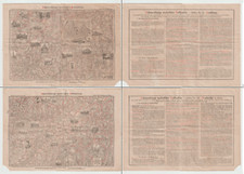
This antique folding map of Moritz Schauenburg from the 1880s - 1890s is a great addition to any collection. The map features detailed information on the cities of Hamburg and Karlsruhe, as well as the surrounding region of Baden. The date range of the map is from 1800-1899, making it a rare find for collectors of antique maps.The map is in its original form and has been well-preserved over the years. It is a great way to explore the history of Germany and the cities of Hamburg and Karlsruhe. This map is perfect for anyone interested in antique maps, Europe, and Germany.
Map is not shown fully open for ease of viewing and one would be upside down.
Length: 13.25 inches
Height: 9.25 inches (while folded)
(dimensions are approximate and while folded)
Please refer to item photos for full visibility of item condition. Feel free to ask questions. Item is sold \"as is\". Map has some holes, tears, and staining,Item may have some damage including, tears, staining, writing, stickers, spine and cover damage, etc. Please refer to all photos for accurate details on condition.