Heat.net Store Home
|
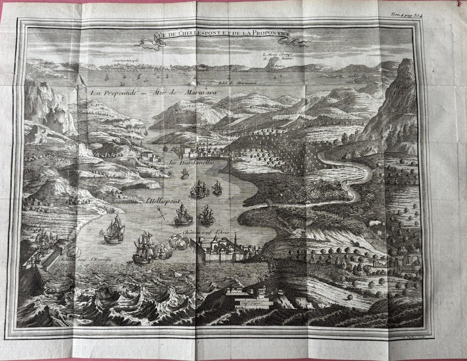
DARDANELLES CONSTANTINOPLE TURKEY c. 1705 NICOLAS DE FER ANTIQUE VIEW For Sale

When you click on links to various merchants on this site and make a purchase, this can result in this site earning a commission. Affiliate programs and affiliations include, but are not limited to, the eBay Partner Network.

DARDANELLES CONSTANTINOPLE TURKEY c. 1705 NICOLAS DE FER ANTIQUE VIEW:
$450.00
Title of the view:\"VEUE DES DARDANELLES DE CONSTANTINOPLE\". Nice antique copper engraved view of the strait of Dardanelles, in Constantinople, Turkey, by Nicolas de Fer. This nice view is focused on the Dardanelles Strait in Turkey, known historically as the Hellespont, and captures the strategic waterway leading to the city of Istanbul (Constantinople). The engraving is detailed and depicts the landscape in a pictorial relief style, illustrating the geographical features and fortifications along the Dardanelles. The engraving prominently features fortifications along the strait, such as \"Chateau Neuf d\'Europe\" and \"Chateau Neuf d\'Asie,\" indicating the defensive structures that protected the passage. The piece includes various geographical landmarks like the \"Mont Athos\" and the \"Isle de Marmora,\" providing context and orientation within the region. The depiction of the strait itself, labeled as \"L\'Hellespont,\" is central to the composition, illustrating the narrow passage and the strategic positioning of forts.The Dardanelles Strait is a crucial point of passage between the Aegean Sea and the Sea of Marmara, leading towards Istanbul. This region held significant military importance due to its control over naval passage to and from the Black Sea. The map was created during an era of significant military and territorial conflicts in Europe and the Ottoman Empire. The depiction of the Dardanelles reflects the geopolitical importance of the strait in controlling access to Constantinople, a major cultural and economic hub of the time.We join the original descriptive text of the view.Nicolas De FER (1646-1720) is one of the famous geographe of XVIIIe century. His earliest wellknown map of the canal de Languedoc, realised in 1669. In 1697, he published his first world atlas. De Fer has created this view when he was in service of the King of France Louis XIV. In 1695, De Fer, with several other notable French mapmakers, became founding contributors to the French Bureau of Maps and Plans. This bureau, created to deal with the technical and strategic problems of overseas commerce and exploration, was part of the Royal Academy of Sciences’ Ministry of the Navy and Colonies. Edition : Paris, c. 1705, 18th CenturySize with margins : 38 x 26,5 cm / 14,9 x 10,2 inchesCondition : very good condition, well engraved.
|
|
Other Related Items:
Related Items:
AUSTRIA, Turkey, 1905. Post Card 2, Constantinople -- Dardanelles $6.38
DARDANELLES CONSTANTINOPLE TURKEY c. 1705 NICOLAS DE FER ANTIQUE VIEW $450.00
BOSPORUS STRAIT dated 1905 İstanbul TURKEY Original Dardanelles $12.50
|
