When you click on links to various merchants on this site and make a purchase, this can result in this site earning a commission. Affiliate programs and affiliations include, but are not limited to, the eBay Partner Network.
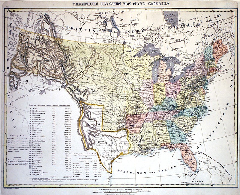
Original Antique Map by Carl Flemming, 1845
MAP OF UNITED STATES and the INDEPENDENT REPUBLIC of TEXAS
M-10456: "VEREINIGTE STAATEN VONNORD-AMERICA'' Glogau (Germany /Poland): Carl Flemming,c. 1845. Lithographed map with hand-coloring. Right & left marginsextended to facilitate matting.
Image Size: 12 1/4 x 16 1/8 inches
This handsome map depicts the United States and itsTerritories numbered and in contrasting colors. The Republic of Texas(an independent nation until joining the United States in December, 1845)is also named and separately outlined.
The ''German Colony'' is located within theRepublic of Texas (west of Austin). Texas claimed the region westward to theRio Grande and northward to the Arkansas River (an area they held until the Compromiseof 1850), while Mexico insisted Texas’ boundaries only extendedwestward to the Nueces and northward to the Red River.
The chart at the leftlists the 29 US States and Territories and 3 ''Districts'' along withtheir area and population.
Also listed is the population for 7 major U.S. citiesaccording the Census of 1820 and 1840. Indian Tribes are locatedthroughout the map, and notes regarding the controversial northwest boundary ofOregon Territory (settled in 1844) are provided off the northwest coast.
This is an original map over 175 years old, not a reproduction.It is abeautiful example with bright original as shown in the photos, right and left margins extended to facilitate matting.. It comes with a Certificate of Authenticity.
We have been full-time dealers in Illuminated Manuscripts, Maps, Prints and Antiquities since 1980.